Why in NEWS
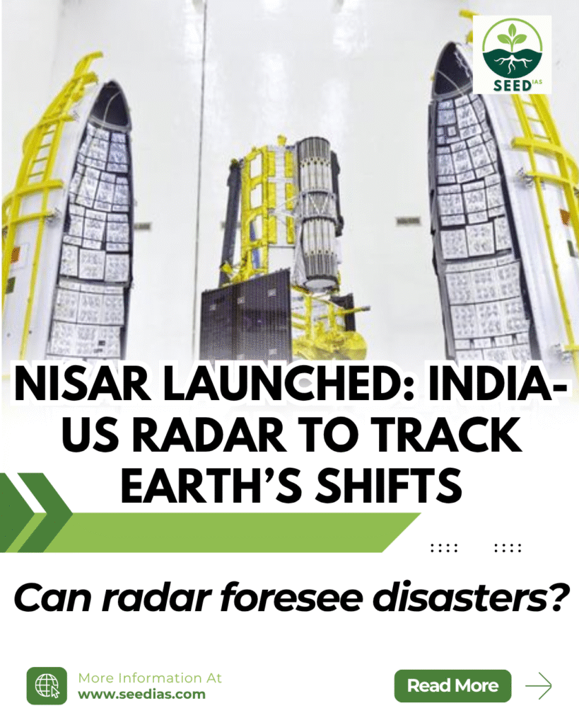
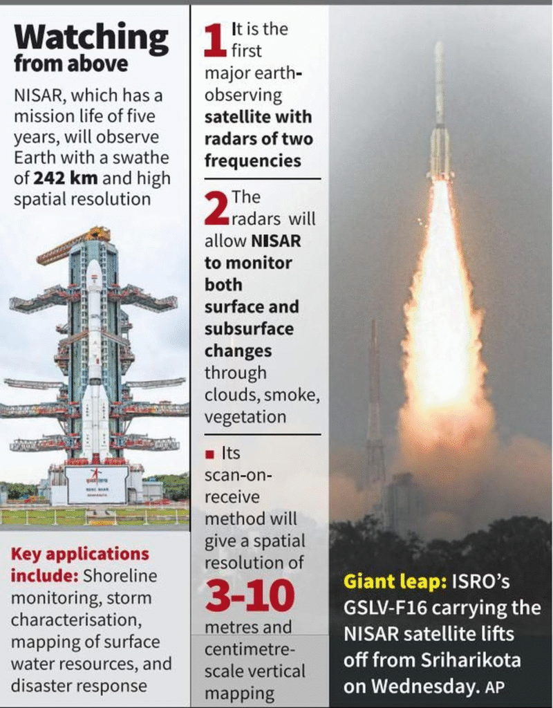
ISRO successfully launched the NASA-ISRO Synthetic Aperture Radar (NISAR) satellite from Sriharikota, marking a landmark Earth observation mission and strengthening India–US space collaboration.
Key Terms and Concepts
| Term | Explanation |
|---|---|
| NISAR | NASA-ISRO Synthetic Aperture Radar satellite for dual-frequency Earth observation |
| Synthetic Aperture Radar (SAR) | Active radar system that creates high-resolution images by combining successive radar signals |
| L-band Radar | Lower-frequency radar, ideal for penetrating vegetation and soil |
| S-band Radar | Higher-frequency radar, better for surface-level features like agriculture |
| GSLV Mk II | India’s Geosynchronous Satellite Launch Vehicle used for heavy satellite launches |
Key Facts About NISAR
| Feature | Description |
|---|---|
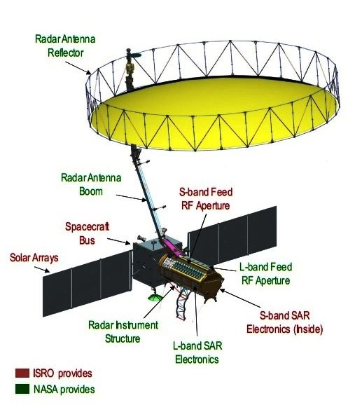
| Type | Earth-observing radar satellite using dual-frequency SAR |
| Developers | Jointly by NASA (L-band) and ISRO (S-band) |
| Launch | By ISRO from Sriharikota using GSLV Mk II (GSLV-F16 variant) |
| Orbit | Sun-synchronous polar orbit |
| Antenna | 12-meter diameter, deployed 9 meters from satellite body |
| Mission Life | 5 years (after 90-day commissioning) |
Mission Objectives and Applications
| Domain | Purpose |
|---|---|
| Disaster Monitoring | Detect ground shifts from earthquakes, landslides, volcanic eruptions |
| Forest & Carbon Studies | Measure biomass and carbon stock through woody vegetation tracking |
| Agricultural Monitoring | Track crop cycles, extent, and growth stages |
| Wetland and Water Study | Monitor seasonal wetland changes and hydrological patterns |
| Cryosphere Surveillance | Observe melting of glaciers and sea ice in polar regions |
Significance for India
| Benefit | Explanation |
|---|---|
| Strategic Ties | Reinforces Indo-US cooperation in space via joint science missions and Artemis Accords |
| National Development | Aids in planning for agriculture, climate adaptation, and natural disaster response |
| Scientific Leadership | Boosts India’s global profile in remote sensing and Earth science as a ‘Vishwa Bandhu’ |
What is a Radar Band?
| Band | Frequency Range | Use Case |
|---|---|---|
| L-band | 1–2 GHz | Penetrates vegetation and soil; used for deformation and forest studies |
| S-band | 2–4 GHz | Ideal for surface features like wetlands, crops |
| X/Q/V/W-bands | Higher ranges | Used for finer resolution but less effective in cloudy/rainy conditions |
In a Nutshell
Code: “EARTH MAP”
Earth observation
Agriculture & biomass tracking
Radar tech (L & S bands)
Tectonic deformation
Humanitarian aid from disaster data
Melt monitoring of glaciers
Artemis accords tie-in
Precise global mapping every 12 days
Prelims Practice Questions
- Which of the following is true about the NISAR satellite?
A. It uses X-band radar for high-resolution imaging
B. It is developed solely by NASA
C. It uses both L-band and S-band radar
D. It is placed in a geostationary orbit - The L-band radar on NISAR is particularly useful for:
A. Monitoring only crop growth
B. Penetrating ice, vegetation, and soil to detect land deformation
C. Observing city lights at night
D. Tracking weather events in real time - What is the function of Synthetic Aperture Radar (SAR)?
A. To detect black holes
B. To map Earth’s surface through clouds and vegetation
C. To provide GPS signals to mobile phones
D. To measure atmospheric pressure
Mains Practice Questions
- NISAR reflects a new era of collaborative Earth observation. Examine the scientific and strategic importance of the mission for India. 10 Marks
- How can radar-based Earth observation missions aid disaster risk reduction and climate change mitigation? 10 Marks (GS3 – Science & Tech + Environment)
Answers and Explanations (Prelims)
| Qn | Answer | Explanation |
|---|---|---|
| 1 | C | NISAR uses dual-band radar: L-band by NASA and S-band by ISRO |
| 2 | B | L-band radar can penetrate vegetation and ice to detect ground movement |
| 3 | B | SAR creates high-resolution images even through clouds and tree cover |